
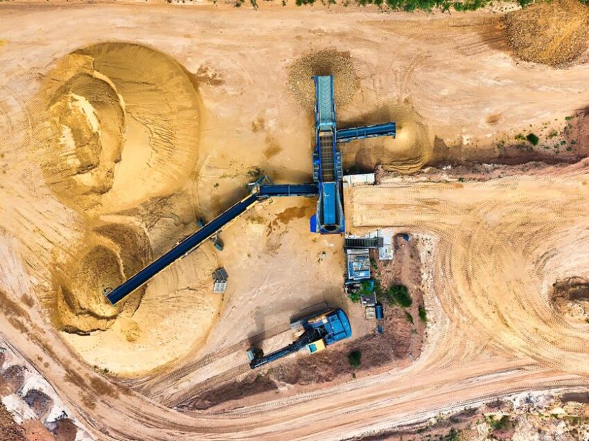
Steep rock faces, heavy equipment, and constant movement make quarries some of the most challenging industrial environments to monitor and manage. In recent years, survey drones for quarries have become indispensable tools, offering a safer and faster alternative to manual site inspections. With reliable data collection and aerial oversight, these drones are changing the way quarry operations approach safety and efficiency.
How drones are transforming commercial quarry inspections
Traditional quarry inspections demand significant time, manpower, and often require workers to operate in hazardous zones. Survey drones can complete a comprehensive site scan in a fraction of the time, reducing the need for workers to access unstable ground or high ledges. By providing real-time high-resolution imagery and 3D mapping, drones enable site managers to make informed decisions without putting anyone at risk.
The adoption of commercial drones also enables more frequent inspections, identifying potential issues, like ground subsidence or equipment wear, before they develop into major safety hazards. With rapid deployment, drones can cover large or inaccessible areas and deliver detailed reports, streamlining compliance with regulations and improving operational oversight.
Drone utility inspection: Beyond basic mapping
Modern survey drones are equipped with advanced sensors and cameras that handle more than just topographical mapping. Multispectral and thermal sensors allow for the detection of hidden cracks in stone, overheating equipment, or even unauthorized activity on the site. By extending their role into utility inspection, drones help prevent equipment failure and enhance resource management.
For example, a drone can quickly assess the status of conveyor belts, crushers, and storage piles, flagging anomalies without halting production. The integration of real-time data into site management systems creates a feedback loop, enabling proactive maintenance and reducing costly downtime.
Drone security and ongoing surveillance in quarries
Security is a continuous concern for quarries, which often cover vast, remote areas. Surveillance drones provide persistent monitoring, offering live feeds that can be used to detect trespassers, track vehicle movement, or monitor stockpile integrity. Automated flight paths and scheduled missions mean that site security isn’t dependent on manual patrols, and coverage is consistent day and night.
In addition, surveillance data gathered by drones can serve as a valuable record for investigating incidents or resolving disputes about deliveries and inventory levels. The presence of visible drones can also act as a deterrent, lowering the risk of theft or vandalism.
Understanding UAVs and drones: What’s the difference?
The terms “drone” and “UAV” (unmanned aerial vehicle) are often used interchangeably, but in the context of quarry operations, a UAV typically refers to the aircraft itself, while “drone” often describes the complete system, including onboard sensors and software. For practical purposes in quarries, the distinction is minor, what matters is the capability to carry out automated mapping, inspection, and monitoring tasks reliably and efficiently.
Choosing the right solution for your quarry
When considering survey drones for quarries, evaluate factors like flight time, payload capacity, mapping precision, and ease of integration with your existing data systems. Start by identifying your site’s specific risks and requirements, then match them with a drone system that offers the right mix of sensors and autonomy for your environment.
If you want a deeper dive into selecting commercial drones for industrial monitoring, look for guides that compare leading models, explain regulatory considerations, and cover training and deployment strategies. These resources can help you design a safer, more efficient inspection workflow tailored to your quarry’s needs.